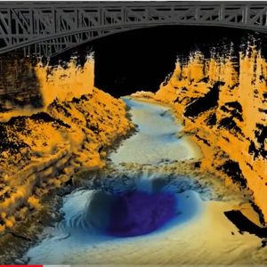
Blowing my own trumpet here as I made the Fledermaus fly-through, but it is a great dataset that was collected by Seahorse Geomatics for the USGS using a Norbit iWMBS system and their new laser system. I processed the bathymetry and laser in Qimera and then did the visualisation trickery in Fledermaus.
Category: Norbit
Gallery


