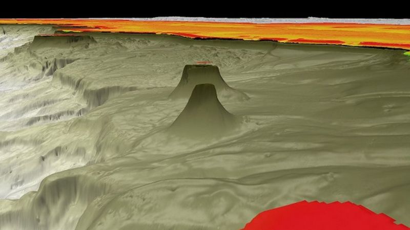
R3 Vox (R2Sonic’s new incarnation in Malta) will hopefully be releasing the Voxometer in Q1 next year. It is a multibeam, but then it isn’t, as it collects voxels (squares) of data at multiple frequencies all at the same time. This will open up new products, acquisition methods and could really be a game changer. […]
Dec
05
2023
Voxometer® – new sonar measures voxels not beams
R3 Vox (R2Sonic’s new incarnation in Malta) will hopefully be releasing the Voxometer in Q1 next year. It is a multibeam, but then it isn’t, as it collects voxels (squares) of data at multiple frequencies all at the same time. This will open up new products, acquisition methods and could really be a game changer. […]
Dec
04
2023
EGU Multibeam water column session
Get your abstract writing mits out for the European Geophysical Union session on multibeam water column data.
Dec
04
2023
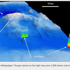
A nice example of why we need to map the Oceans properly!
Research Vessel Flakor (too) discovering new seabed features each time it goes out. Massive New Seamount Discovered in International Waters Off Guatemala – Schmidt Ocean Institute:
Jun
10
2022
Norbit Winghead data examples
Better late than never but here are some examples from the Norbit Wingheads that we have. An offshore windfarm export cable exposed; Some really nice geology in the North Sea;
Nov
17
2020
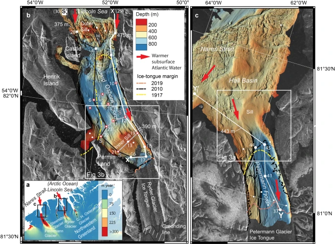
Ryder Glacier in northwest Greenland is shielded from warm Atlantic water by a bathymetric sill | Communications Earth & Environment
Fascinating article by Martin Jakobsson and Larry Mayer on why the Ryder Glacier isn’t disappearing like the Petterman Fjord. Ryder Glacier in northwest Greenland is shielded from warm Atlantic water by a bathymetric sill | Communications Earth & Environment:
Nov
15
2020
NORBIT WINGHEAD®️ Multibeam Sonar – YouTube
Hopefully I’ll get round to analysing the data we collected for an export cable using this sonar next week. NORBIT WINGHEAD®️ Multibeam Sonar – YouTube:
Nov
15
2020
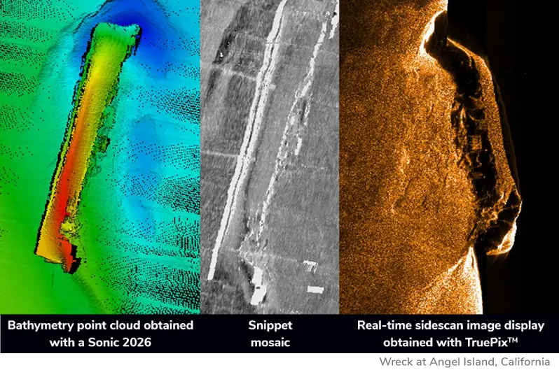
Snippets vs TruePix™, how do they compare? – R2Sonic
One of the reasons we use R2Sonic sonars for asset inspection is because of its TruePix sidescan output. This excellent article explains why/how it is different to Snippets backscatter. Snippets vs TruePix™, how do they compare? – R2Sonic:
Oct
29
2020
Great Barrier Reef: Scientists find reef taller than Empire State Building – BBC News
Great Barrier Reef: Scientists find reef taller than Empire State Building – BBC News: More great work by Dr Robin Beaman and the survey team on Schmidt Ocean’s Falkor.
Oct
28
2020
Multibeam.net back up and blogging
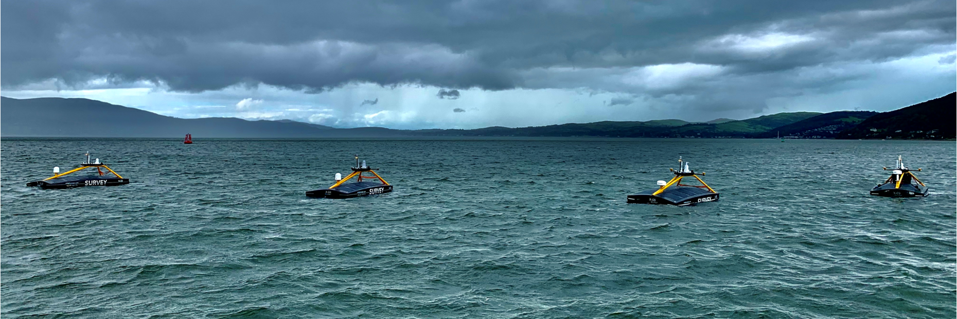
Now that I am the Chief Strategy Officer for XOCEAN I thought I would get back to blogging about any high resolution seabed mapping related news. So my first post should be about the amazing XO-450 USVs. We are currently up to X09 and should be to X12 by early next year. The only USV […]
Oct
28
2020
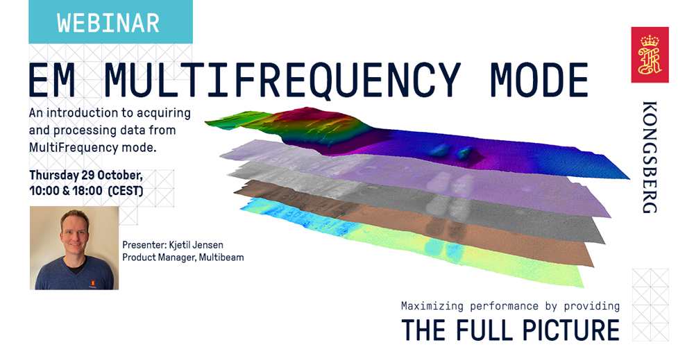
Kongsberg launching MultiFrequency mode
Kongsberg are launching “MultiFrequency mode” and there is a webinar tomorrow to sign up to https://www.kongsberg.com/maritime/about-us/news-and-media/blog-stories/webinar-em-multifrequency/ Similar to R2Sonic’s multispectral mode maybe?
Gallery


