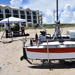
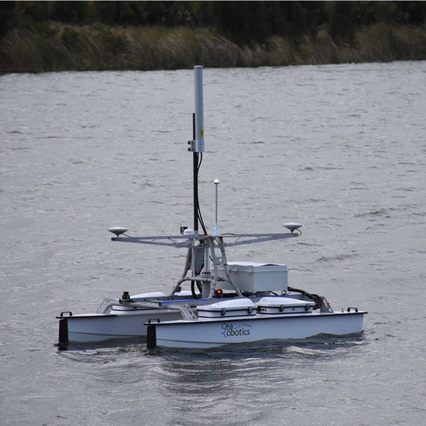
ASV Harry has just completed his acceptance trials and there were a number of tests that we performed which are unique to ASVs, which I thought I would share. Wifi Link Test The SeaRobotics ASV is autonomous but it is always good to see what is going on and how do you communicate nowadays – […]
Apr
03
2017
Time for a new chapter – 4D Ocean
Today is the first day for 4D Ocean which I set up to provide autonomous survey solutions to the seabed mapping community! The technology is now there to be able to do fully autonomous surveys but it is still early days and requires a great deal of investment in how to do it and the […]
Dec
15
2016
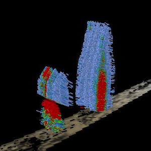
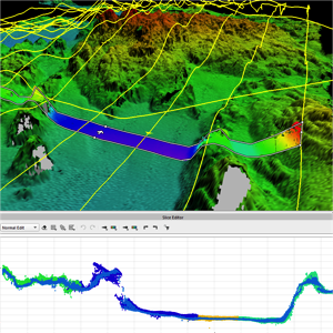
Massive Gas Seeps
I’ve been helping out a potential client with extracting data from the water column packets of an @TeledyneRESON multibeam system in 1500m of water. It was only when I extracted it (using the new awesome water column tools in @QPSQimera) that I realised how big they were. One is 750m high and the other is […]
Nov
23
2016
NZ coast rises 1.5 m near Kaikōura
This is pretty amazing to see. An entire bay has become dry following the 7.8 magnitude earthquake off New Zealand last week. A bay on the Kaikōura coast has moved up 1.5 m and therefore is now pretty dry. Photos by Casey Milne (pre) and Andrew Spencer (post)
Nov
22
2016
AUV processing
I’ve been taking different AUV datasets through Qimera and I must say, it is really easy. It is even easier now that as well as the post processed inertial SBET format, I have been beta testing the Kongsberg Navlab post processed position and pressure formats too. It only took a minute to get all the […]
Nov
04
2016
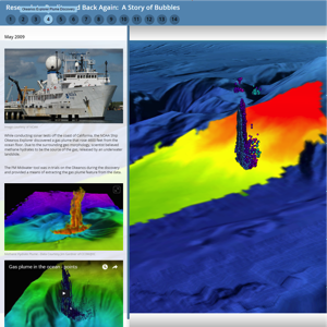
Fantastic ESRI Story Map on the history of multibeam water column
This fantastic story map provides a history of the development of water column processing from research to reality. It was put together by Moe Doucet (@metamoe) from QPS and Victoria Price from Normandeau Associates. They presented it at @ESRIOceans this week. Well worth a view.
Nov
03
2016
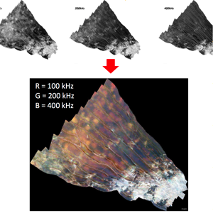
See the seafloor in new ways – Multispectral Backscatter
R2Sonic have just released a new firmware update that allows the system to ping in succession at different frequencies. It works best on the Sonic 2026 as this can ping at 100 kHz, 200 kHz and 400 kHz. QPS QINSy records the frequency with each ping and then FMGT (the backscatter app) processes each frequency […]
Sep
08
2016
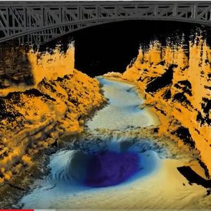
Grand Canyon combined multibeam and laser survey
Blowing my own trumpet here as I made the Fledermaus fly-through, but it is a great dataset that was collected by Seahorse Geomatics for the USGS using a Norbit iWMBS system and their new laser system. I processed the bathymetry and laser in Qimera and then did the visualisation trickery in Fledermaus.
Aug
16
2016
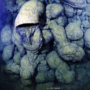
Using “hydroacoustic properties” to date lava flows
Isobel Yeo of GEOMAR’s Helmholtz Institute for Ocean Research Kiel is calculating the date of lava flows from undersea volcanoes by using the reflectivity returned by sonar backscatter. Nice article on the BBC website here http://www.bbc.com/earth/story/20160808-the-volcanoes-hiding-in-the-ocean and her paper can be downloaded here http://www.sciencedirect.com/science/article/pii/S0012821X16000510
Aug
11
2016
R2Sonic have released a major firmware update
It looks like R2Sonic have been busy. Pitch stabilisation and ROBO mode! Major firmware & GUI releaseStandard frequency range is expanded to 170-450kHz for Sonic 2026 systems, and Sonic 2022 and 2024 systems with model 1006 projectors.GUI now includes ROBO Mode for shallow water surveys less than 40m in depth, simplifying sonar operation.700kHz UHR option […]
Gallery


