If you are wanting to collect great backscatter data to create mosaics then this poster from Jonathan Beaudoin is a must read. It shows you how to set the sonar up, use SVP data and then process it in FMGT. Download the poster and stick it on your wall here http://www.qps.nl/download/attachments/14352930/beaudoin_r2sonic_poster.pdf?version=1&modificationDate=1400116368523
Category: Multibeam
Jul
29
2015
ESRI’s Chart Server – super cool!
Here is the link to the NOAA ENC server powered by ESRI’s Chart Server. You can see the ENCs normally or you can use them with the ESRI Basemaps like the Image one in the second picture. The ENC can be fully inspected too. A bit more info; The NOAA ENC Online viewer is […]
Nov
11
2014
Nice use of 3 different types of underwater mapping
Pearl Habour wrecks surveyed with multibeam, LiDAR and underwater photogrammetry. Coolest thing is making models of wreck artefacts by using 3D printers. The small USV is also pretty impressive – complete with R2Sonic 2020.
Nov
05
2014
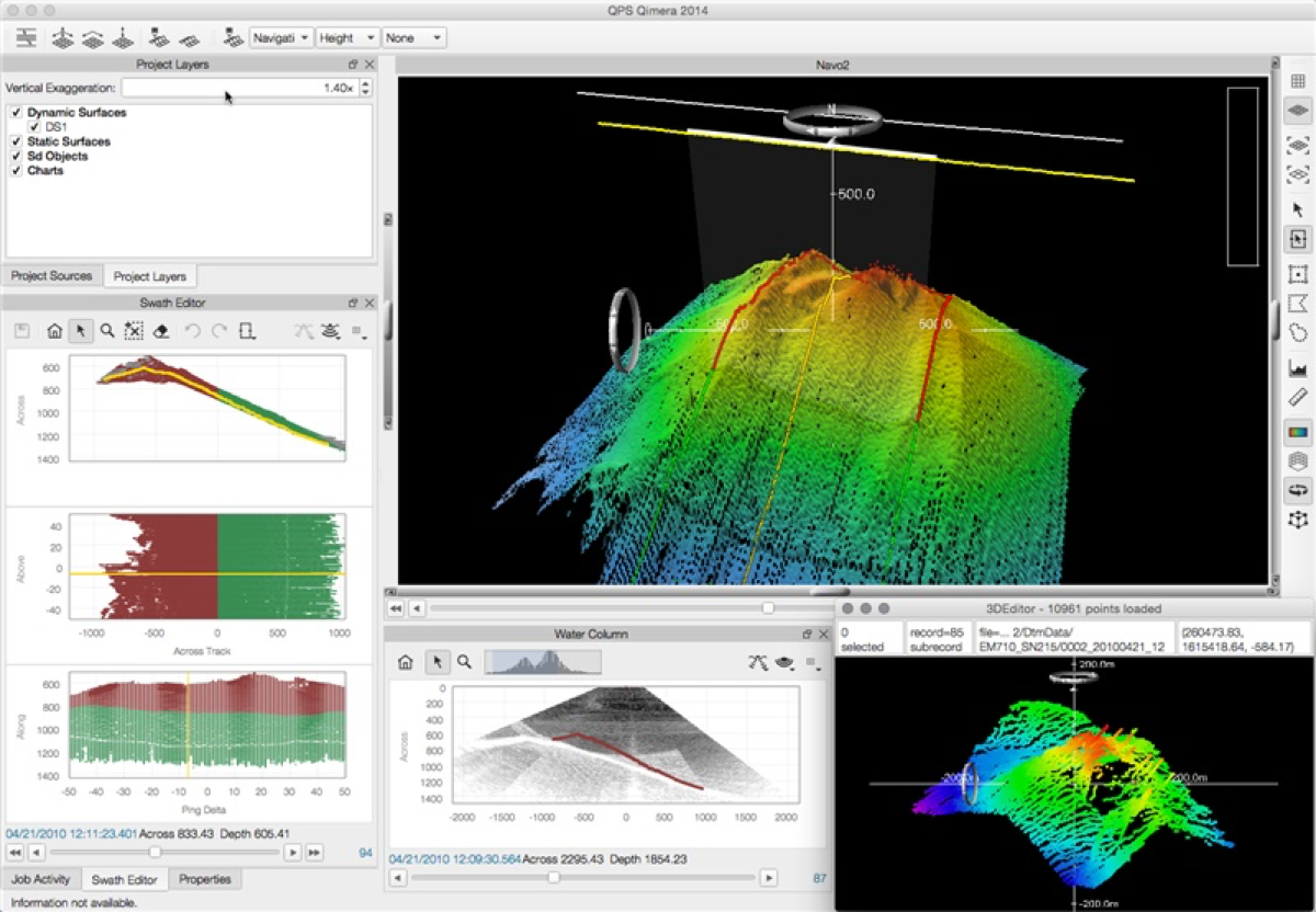
Qimera – very exciting
I’ve been working on this for a few months now and finally we can talk about it. Qimera should really change the way that multibeam data is processed. No complicated setup, an intuitive interface and unbelievably powerful features and speed. More posts to follow on this!
Sep
01
2014
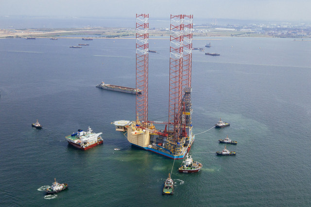
Going to need a head for heights to setup the GPS antennas on this one
Look how deep the heavy-lift vessel had to ballast down – 20.5 m! http://www.offshoreenergytoday.com/largest-jack-up-rig-in-the-world-on-a-12-000-miles-journey/ #epicjourney
Sep
01
2014
Always interesting when multibeam manufacturer’s get bought
Teledyne RESON buys Atlas Hydrographics
Sep
01
2014
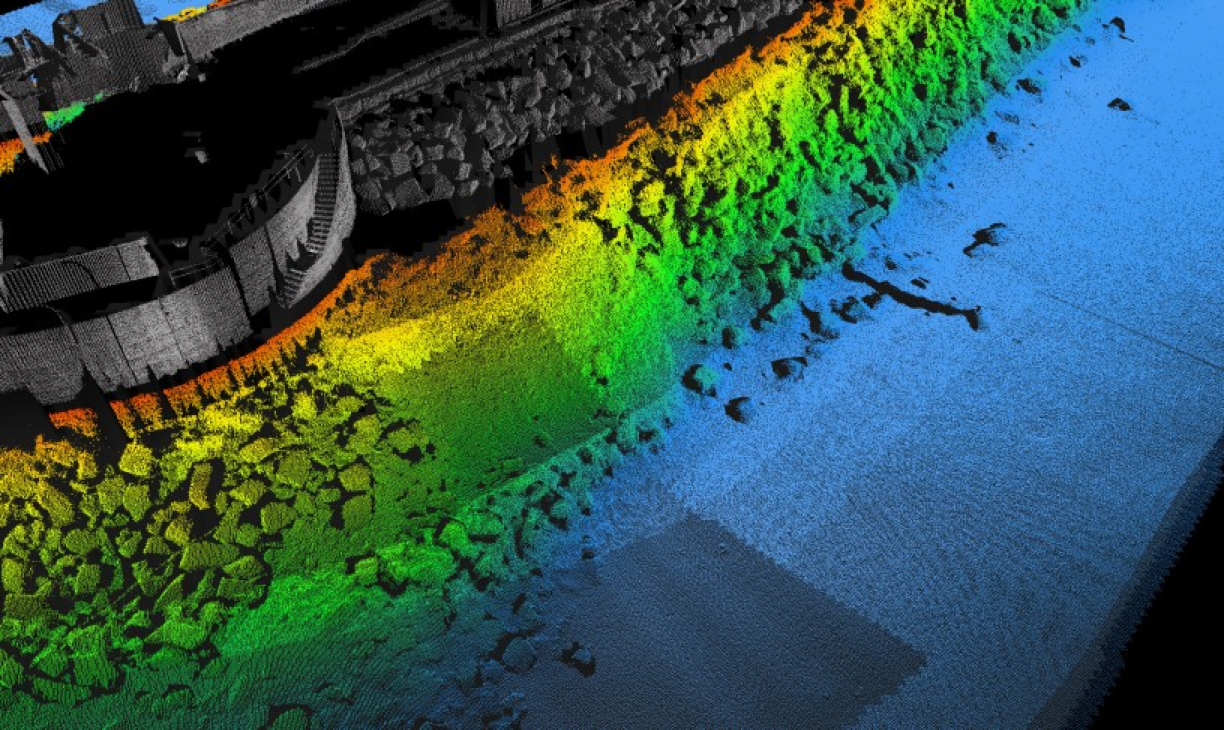
Integrating multibeam & laser
I’m presenting at the RESON UTS in Hamburg on getting the data right when collecting multibeam and laser data combined. To give you a taster, here’s an image from a survey we conducted at Portland Harbour recently. @RESON_Seabat http://mmt.se/news-media/laser-bathymetry-survey/
Jul
31
2014
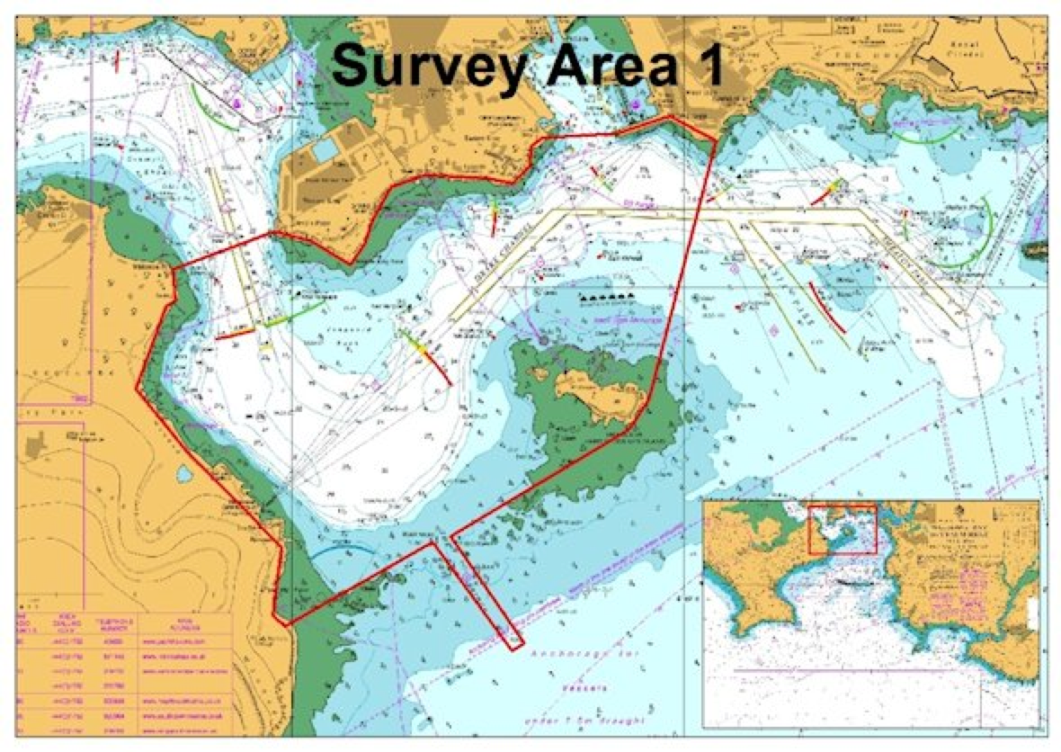
Shallow Survey Dataset Collection underway
Shallow Survey, the high resolution seabed mapping conference is back in Plymouth in September 2015. To go with the conference is the Common Dataset. Find out more here http://www.shallowsurvey2015.org/default.asp?page=commondataset
Jul
29
2014
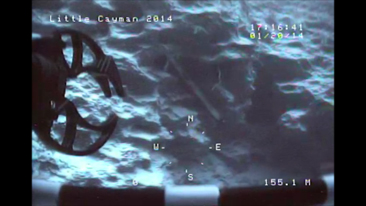
Val Schmidt and the Lost AUV
An excellent, if a little sweaty palms, story of how an AUV was lost and then found. It is bad enough to lose a sidescan or ROTV (we did 2 years ago but luckily it was washed up on a beach) but an AUV is even more expensive!
Gallery


